If you are like me you may needed to add a map on a website. This seems not so trivial to do!
First of all you need to pick a map source:
- Google Maps
- OpenStreetMap (OSM)
- Apple Maps
- Others
As of recently I am trying to use Google's products less and less. So let's skip that option.
OSM is big:
on 2023-02-01, the plain OSM XML variant takes over 1696.6 GB when uncompressed from the 123.4 GB bzip2-compressed or 67.3 GB PBF-compressed downloaded data file
Ref: https://wiki.openstreetmap.org/wiki/Planet.osm
Now that you picked the source of your map how do you display it to the user?
Raster tiles
Raster tiles are pre-rendered images of a certain location.
If you want to display a map without any dependencies you can just load the needed tiles and join them together.
Sample libraries
- Leaflet js uses raster tiles.
Vector tiles
If you want to be modern and cool and can take a look at vector tiles. Vector tiles are tiles that still need to be rendered.
When using raster tiles, if you want to change the map style, you have to use a different set of tiles (often called a tile layer). Whereas with vector tiles, you can simply apply a different style to the same tiles (since the rendering happens on the client-side).
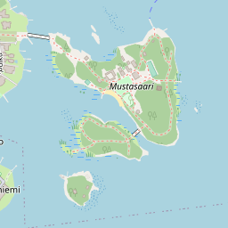
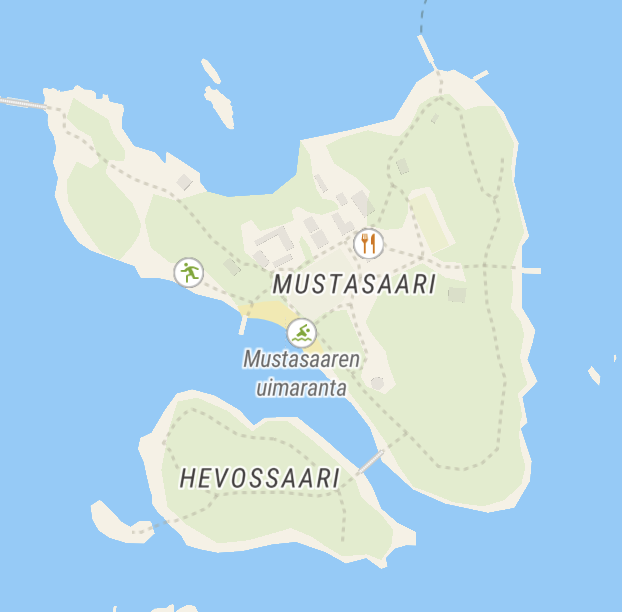
Seems like OSM doesn't support this yet so we will use another tiling provider for examples. Let's pick a server from this list.
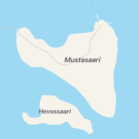
Can we fetch the exact same area but as vector? I have queries both MapTiler and Qwant. Vector tiles are returned in PBF format (protobuf). Let's explore its contents:
$ nix-shell -p osmium-tool

$ osmium fileinfo 9484.pbf
File:
  Name: 9484.pbf
  Format: PBF
  Compression: none
  Size: 12483
PBF error: invalid BlobHeader size (> max_blob_header_size)
Oops... Apparently, osmium expects a complete map, like liechtenstein-latest.osm.pbf.
In our case we just need to parse a single vector tile in mapbox format. OK let's try to read with Deno using JS libraries:
import Protobuf from 'npm:pbf';
import { VectorTile } from "npm:@mapbox/vector-tile";
import { readFileSync } from "node:fs";

const pbf = new Protobuf(readFileSync('9484.pbf'));
const tile = new VectorTile(pbf);
console.log(tile);
Trimmed result:
VectorTile {
  layers: {
    water: VectorTileLayer {
      version: 2,
      name: "water",
      extent: 4096,
      length: 2,
      _keys: [ "id", "class", "intermittent", "brunnel" ],
      _values: [ "ocean", 645439964, "swimming_pool", ... ],
      _features: [ 11, 927, ... ]
    },
    landcover: VectorTileLayer {
      version: 2,
      name: "landcover",
      extent: 4096,
      length: 30,
      _keys: [ "class", "subclass" ],
      _values: [ "wetland", "grass", ... ],
      _features: [ 1051, 1103, ... ]
    },
    landuse: VectorTileLayer {
      version: 2,
      name: "landuse",
      extent: 4096,
      length: 8,
      _keys: [ "class" ],
      _values: [ "playground", "residential", "pitch" ],
      _features: [ 3257, 3295, ... ]
    },
    place: VectorTileLayer {
      version: 2,
      name: "place",
      extent: 4096,
      length: 9,
      _keys: [ "name", "name_en", ... ],
      _values: [ "Haapasaari", "Aspholmen", "island", ... ],
      _features: [ 8335, 8371, ... ],
    },
    ...
  }
}
Sample libraries
Raster vs Vector
| Raster | Vector | |
|---|---|---|
| Simple | ✓ | ⨯ |
| Size | ⨯ | ✓ |
| Customizable | Need server to render differently | Change labels, styles when rendering on the client |
| Client support | ✓ | ~ |
| Tiling server | Can use OSM for low volume queries | Need to use a third-party server |
- Third-party server: You can also set up your own server. First, download the data from OSM. Second, convert OSM map data to vector tiles. Finally, host your tiles.
Apple maps
Why Apple maps? I have an Apple Developer account so I do get this kind of for free.
MapKit JS provides a free daily limit of 250,000 map views and 25,000 service calls per Apple Developer Program membership.
// Import TypeScript type definition for use in Deno
import _ from "https://cdn.skypack.dev/@types/apple-mapkit-js-browser?dts";

const mapKitToken = "my-jwt-token";

// Load and init the map
const script = document.createElement("script");
script.setAttribute(
  "src",
  "https://cdn.apple-mapkit.com/mk/5.x.x/mapkit.core.js",
);
// This attribute instructs the browser to connect to the MapKit JS CDN using anonymous credentials mode.
// This improves performance by allowing subsequent MapKit JS network requests to reuse the same HTTP/2 connection.
script.crossOrigin = "anonymous";
script.dataset.libraries = "map,annotations";
script.dataset.callback = "initMapKit";
document.head.appendChild(script);

window.initMapKit = () => {
  mapkit.init({
    authorizationCallback: (done) => {
      done(mapKitToken);
    },
  });

  // Display map on the page
  const map = new mapkit.Map(document.querySelector('#map-container'));
};
There is a bit of a catch. Apple Maps in some areas has a lot less details.
What to choose?
It is up to you!
If you already have an Apple developer account then you may use Apple's maps. They provide a high daily limit for free. If you website is low traffic then you can use OSM's raster images directly. If you want maps to look a tiny bit better then you will need to pick a third party provider like https://www.maptiler.com/.
Google maps is also an option if you are into that sort of thing.